
Please note: Some of the following maps are dynamic and the content will change periodically based on the nature of the emergency or disaster, and location status.
Winter weather map
View current stream gauge readings, road closures, and evacuations.

Know Your Zone
Evacuation zones are boundary specific areas identified by the Sonoma County Sheriff’s Office, that are used during emergencies to notify communities of an imminent threat or danger.

Road closures and delays
Road closures and delays on county roads and city streets within Sonoma County. This list does not include events on state highways, private roads, or any roads outside of Sonoma County.

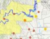
Flood stage map
View the Russian River flood planning map.

Five-year burn scar map
Residents living in and around wildfire burn scar areas are at higher risk of flash floods, rock falls and mud and debris flows and are reminded to be prepared for these hazards associated with storms.